
Maps shape our understanding of the world. The most popular world map that we all use all the time, known as the Mercato map is a good journey planning map. However it is flawed in terms of actual visual representation of the world sizes due to the projection from 3D Globe to a 2D flat representation of the world.
Projections
This method of trying to visualize a 3D Globe surface to a flat 2d rectangular space is called projection. Currently, the most popular map projection used is called the Mercator projection. It basically translates a Globe to a Cilinder representation.

Source: https://www.thetruesize.com/
Most accurate projection today
However recently a very unique projection map called Authagraph World Map was created by the Japanese which also won the Good Design award from Japan.
The AuthaGraph projection was invented in 1999 by Japanese architect Hajime Narukawa, and is one of the most innovative approaches to mapping today. The projection largely preserves the relative area of landmasses and oceans, limits the distortion of their shapes, and avoids cutting continents in half.
The map is made by equally dividing a spherical surface into 96 triangles, transferring it to a tetrahedron while maintaining area proportions, and unfolding it onto a rectangle: it is a polyhedral map projection. The map substantially preserves sizes and shapes of all continents and oceans while it reduces distortions of their shapes, as inspired by the Dymaxion map. The projection does not have some of the major distortions of the Mercator projection, like the expansion of countries in far northern latitudes, and allows for Antarctica to be displayed accurately and in whole.

Not easy to replace the Mercator projection map
To answer this we have to first understand why Mercator projection is so popular. The Mercator is perfect when we want to think of the world map in a GRID VIEW meaning the longitude & latitude perspective. However, the Mercator puts in “adjustments” to the bottom and top of the map. You can see they are taller.
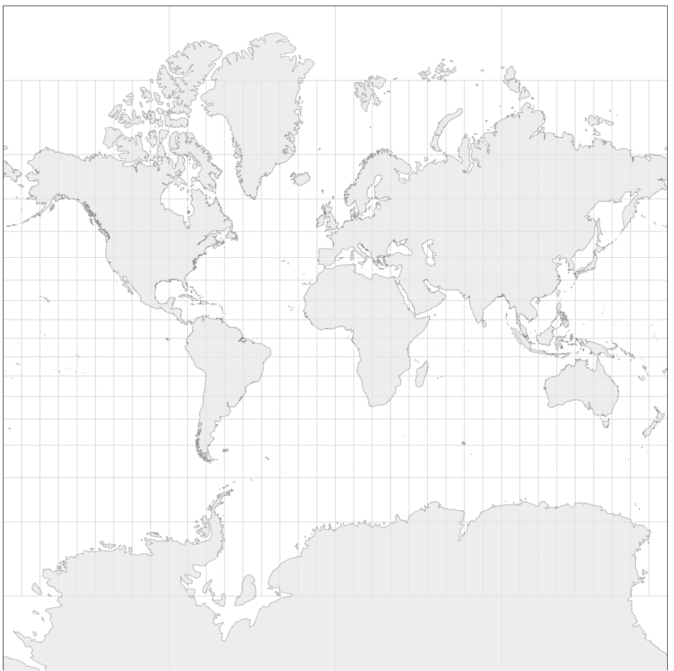
The reason for that is if we keep them all lat & long as square grids those islands on the top will no longer be visible.

Coming back to the question will Mercator maps be replaceable? Probably in the future, as technology becomes more advanced we no longer need to manually find distance and time using the lat & long method. They are automatically calculated for us like google maps. For school-based learning, it is also useful to have the Authagraph map to help more people understand the true size of the world’s continents.
Other types of projections
Explore other types of projections and their coded projection formulas in this site. the one you see below is an equal earth projection.
https://observablehq.com/@floledermann/projection-playground

